Finding groundwater before digging a well can save time and money and prevent frustration in the United States where soil and geology vary widely by region. Many landowners rush into drilling without understanding what lies beneath their property and end up with dry wells or poor water yield. Learning how to tell if your ground hides a water vein involves observing natural signs and understanding soil behavior & using practical assessment methods. With a mix of traditional observation and modern insight you can make a more informed decision before committing to a costly well project.
How to spot water vein signs on your land
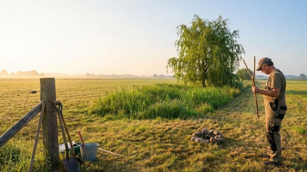
One of the first ways to determine if your property might contain an underground water source is to watch for visible surface signs. Areas with thick grass or vegetation that stays green during dry periods can indicate water below. Certain plants that thrive in wet conditions may also suggest the presence of underground water. Look for slight depressions in the ground or spots that remain damp or where morning dew takes longer to evaporate. These features often point to moisture beneath the surface. You might also notice that plants grow in consistent lines or patterns that follow underground water flow. These observations are not definitive proof but they can give you useful clues before you spend money on professional testing or drilling.

Checking soil and rock for underground water veins
Digging small test pits or looking at soil layers can show you important details about hidden groundwater. Sandy or gravelly soils usually let water move and gather more easily than thick clay which makes soil texture a useful sign. Cracked bedrock or visible seams can point to routes where water flows, called rock fractures. Damp soil layers that remain cool and dark even when the weather is dry might indicate moist sublayers beneath the surface. These physical features help you figure out how water moves underground and whether your property works well for a productive well.

Using research and tools to locate water veins accurately
# Finding Water Underground: Using Research and Expert Help Looking at nature is useful but adding research and professional advice makes your search much more accurate. When you study local maps and geological reports you learn about the rock layers and typical water table depths in your region. Speaking with people who live nearby about their wells shows you what drilling depths work best and how often people find water successfully. If you want even better results you can hire specialists to perform geophysical surveys. These experts use special equipment that measures how electricity moves through soil and detects moisture levels underground. When you mix what locals know from experience with scientific testing methods you stop guessing blindly. This approach gives you a much better chance of finding a water source you can count on for years to come.
Summary or Analysis
Understanding whether your property contains underground water requires observation and careful analysis before you start drilling. You need to examine the landscape & study how soil and rocks behave in your area. Using available information helps you make better decisions & supports smart planning during the planning stage. This method improves cost savings because you can avoid drilling wells that produce no water. It also increases your chances of finding sustainable supply that works well for your home or farm. Taking time to prepare properly makes your well project more practical and ensures it will last for many years.
| Method | What It Reveals | Cost Level |
|---|---|---|
| Surface Observation | Visible moisture indicators | Low |
| Soil Testing | Water-retaining layers | Low to Medium |
| Local Research | Nearby well success | Low |
| Professional Survey | Precise water location | High |
Frequently Asked Questions (FAQs)
1. What is a water vein?
A water vein is an underground channel where groundwater moves through the earth or gathers in one place. These natural pathways form when water seeps down through soil and rock layers until it reaches areas where it can flow more easily. The water follows the path of least resistance as it travels beneath the surface. Water veins develop in different types of geological formations. They often occur in porous rock like sandstone or limestone where water can pass through small spaces and cracks. Sometimes they form along fractures in harder rock where water has gradually worn away the stone over many years. The size of a water vein can vary greatly. Some are narrow channels only a few inches wide while others extend for several feet. The depth also ranges from just below the surface to hundreds of feet underground. Water veins play an important role in the natural water cycle. They help transport groundwater from higher elevations to lower areas. This movement eventually feeds springs & streams or replenishes larger underground reservoirs called aquifers. People have long been interested in locating water veins for practical reasons. Finding these underground water sources has been valuable for digging wells & accessing fresh water supplies. Traditional methods of detection included dowsing with wooden rods though modern technology now uses scientific instruments like ground-penetrating radar and electrical resistivity surveys. The flow rate in a water vein depends on several factors. The slope of the land affects how quickly water moves through the channel. The type of rock or soil determines how easily water can pass through. Seasonal rainfall also influences the amount of water present in these underground pathways.
 Yahoo France: from missing page message to a snapshot of French politics, crime and media debates
2. Can plants really indicate groundwater?
# Plants That Thrive in Areas with Underground Moisture Some plants naturally perform better in locations where water remains available beneath the surface throughout the year. These species have adapted to take advantage of consistent underground moisture sources. Trees like willows and cottonwoods develop extensive root systems that reach deep into the soil to access water tables. Their roots can extend many feet downward to tap into these reliable moisture reserves. River birches also flourish in these conditions and often grow along stream banks where groundwater stays close to the surface. Certain shrubs prefer these moist underground conditions as well. Buttonbush and elderberry both grow vigorously where their roots can access steady water supplies. These plants have evolved to depend on this consistent moisture rather than relying solely on rainfall. Many wetland plants require constant underground water to survive. Cattails and rushes are common examples that need their roots submerged or surrounded by saturated soil. These species cannot tolerate dry conditions and will quickly decline without adequate subsurface moisture. Ferns represent another group that benefits from underground water availability. Species like cinnamon fern and royal fern grow best in areas where the soil remains damp year-round. Their shallow root systems absorb water efficiently from moist upper soil layers. The presence of these indicator plants often reveals where underground water sources exist. Farmers and well diggers have traditionally observed which plants grow in an area to estimate groundwater depth and availability. A cluster of water-loving vegetation typically signals that moisture lies relatively close to the surface. Understanding which plants prefer consistent underground moisture helps gardeners and landscapers choose appropriate species for different locations. Matching plants to their preferred water conditions leads to healthier growth & reduces the need for supplemental irrigation.
3. Is professional surveying necessary?
It is not mandatory, but it greatly improves accuracy before drilling.
4. How deep are most water veins?
Depth varies by region, but many usable veins lie between 30 and 300 feet.
